
Goldsmith Woodlands
Andover Village Improvement Society
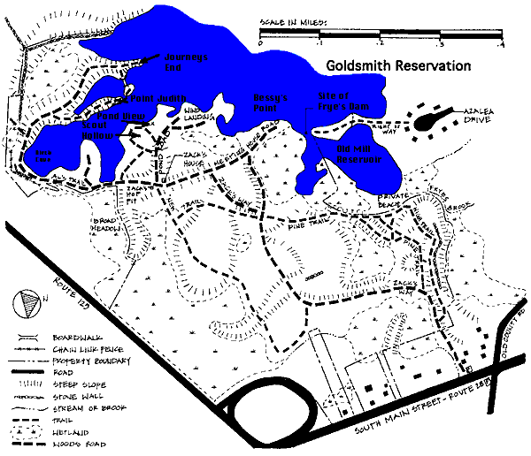
Size: 170 acres
Parking: South Main Street (Rte. 28) near Gould Rd.
Handicapped use: Main trail from Rte. 28 toward pond passable by wheelchairs.
History
An 1830 map shows the Goldsmith family in possession of the woodlands.
During the early 20th century, Goldsmith Woodlands were a favorite summer retreat. Bessie Goldsmith collected rent from those who had cottages on her land. Cellar holes and swing hinges on trees are still visible.
One of these cottages belonged to Zack, a caretaker of these woods and a handyman for the summer residents. His name lives on in the designation of Zack's way, Zack's house and Zack's hop pit.
From the mid-18th century into the early 19th century, the area around Wilmington was known for hops production, and traces of the kilns used to dry the hops are still visible in the Goldsmith Woodlands.
In 1974, Bessie Goldsmith, a dedicated conservationist, donated her woodlands and land inherited from her brother Clarence to the Fund for the Preservation of Wildlife and Natural Areas. That Fund, in turn, was subsumed by the Boston Foundation, which now owns the property. AVIS became the caretaker in 1977, with funds given for maintenance out of Bessie's trust.
Stories about Bessie Goldsmith's somewhat eccentric behavior in her devotion to protecting her woodlands are legendary. She lived in a rustic cabin on a knoll overlooking Foster's Pond. She was known to point her shotgun at trespassers and if she caught people picking blueberries, she demanded they turn the full pail over to her.
Bessie herself favored the camp site at what is now known as Bessie's Point. It's a lovely spot for a picnic; there's a somewhat awkward landing spot for a canoe or kayak at the foot of the hill where Bessie camped.
A trail extends to the very tip of Bessie's Point. Just across a narrow channel there's another peninsula that can be reached from Azalea Drive. Between the tips of the two peninsulas lies the granite base of a colonial dam. The water is quite shallow, and a canoe paddle plunged into the channel can touch the old slab.
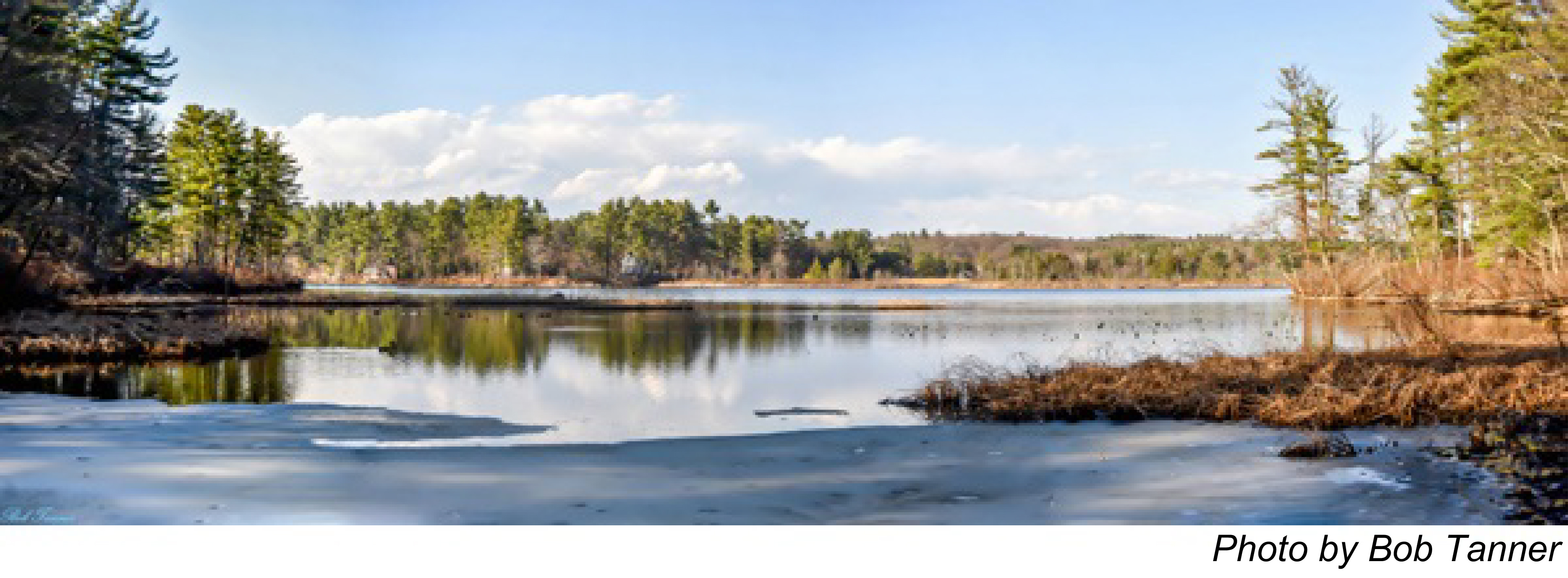
To the east of the ancient dam site, the cove is named the Old Mill Reservoir. At about 15 feet, it is the deepest part of Foster's Pond, dredged in the late 1960s for gravel. If you look carefully, you may be able to spot on the far shore the yellow flags marking the greens of Foster's Pond National Golf Course - the ingenious backyard 9-hole layout of a former resident, maintained by the current owner. Actually, there are three small greens, with a total of 9 different tees strategically located around the Old Mill Reservoir.
Natural features
Some of the trees, rhododendrons and laurels growing along the roadway in Goldsmith Woodlands were planted by Bessie Goldsmith herself. Note the avenues of white pines, so dense that few plants can grow beneath them. The yellow lady slippers are in bloom here in late spring. Other plants rarely seen are visited by Harvard University botanists. The marshes adjacent to the pond are home to cattails, loosestrife, pitcher plants and blue herons.
-- excerpted, in part, from The Bay Circuit and AVIS Guide to Walks in Andover (1992)

 Questions? Comments? Contact us at